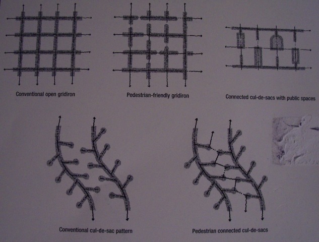
Top Conventional open grid; pedestrian-friendly grid; connected culs-de-sac w/ public spaces Bottom Conventional cul-de-sac; pedestrian connected cul-de-sac
My neighborhood, in Berkeley, is a "pedestrian-friendly gridiron" (also known as a walkable neighborhood). The pedestrian-friendly gridiron is one of five street patterns identified by Southworth and Isaacs (Street Patterns and Pedestrian/Bicycle Connectivity in Streets and the Shaping of Towns and Cities, Southworth and Ben-Joseph, 2003).

Left Conventional open grid Right Pedestrian-friendly grid
If you only consult a street map, like Yahoo, my neighborhood looks like a gridiron. However, if you walk, bike, or drive my neighborhood, you quickly realize the gaps in the grid. These gaps are designed to limit neighborhood auto traffic. Pedestrians and cyclists can move continuously through the neighborhood. Experience it for yourself (or view the Willard/Bateman/LeConte Neighborhood Traffic Calming Plan). Read earlier posts on streets: Bike|Walk and Livable (traffic-calmed) streets.
Comments
Post a Comment
Thank you for commenting on this post!